Max height: 169m Min height: 6m
Total ascent: 813m Total descent: 883m
We had a rather late start again as Daniel and Adeola got lost on the way to the pub finish point. Making use of the extra half hour waiting time at the start, Simon read a book (or possibly had a sleep), while Anne and Sally picked sloes.

Leaving the Chunnel Terminal behind

Folkestone White Horse
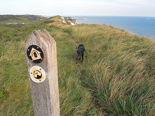
The initial path ran along the cliff top, parallel to the lane, and was rather muddy due to some rain over the preceding few days. As cows grazed the hillside here, there was also quite a bit of ‘poo’ to avoid. After about ½ mile there was another angled view of the White Horse, but it really needed to be photographed from down near the M20 for maximum impact.


Caesar's Camp earthworks

Group photo on Round Hill


Along this section, called Dover Hill, we came across a small herd of Highland cattle (a bit far from home?), which also became the subjects of quite a few photos. Zuka then found her ‘lunch’ in the form of a discarded takeaway, complete with bag, which she carried proudly for some distance. Daniel started a trend for this particular walk by making friends with a couple of elderly horses, one of which was a very curiously coloured Appaloosa cob which had no tail hair at all, poor thing.


Crossing the B2021 we reached the Valiant Sailor pub, where we waited for the stragglers near the outlet of the extractor fan, bathed in the scents of chips and other sundry culinary delights (?!). Gastric juices well stimulated, I think Simon was quite keen to have lunch then and there, but as it was only about noon we were determined to press on for another hour or so.


The route then took us along a scrubby cliff top path. Behind us to the west we were finally saying goodbye to Folkestone (the harbour looked forlorn and empty - passenger ferries no longer depart from here), while ahead of us there were some good views of white cliffs above sandy bays. Some of the ‘sandy’ beaches turned out to be concrete (!), and it is probable that these were built to allow channel tunnel construction vehicles to carry their spoil to the dump site (well, no one could think of a better explanation). The path was narrow and occasionally went through hawthorn ‘tunnels’ or between gorse hedges -some better trimmed than others.


We arrived relatively unscathed at the Battle of Britain memorial site, which covers quite a large area of grass, and is well maintained. There were several separate memorials, grassy banks, a couple of planes, plus a posh information centre with shop and loos. A few of us made use of the facilities and/or purchased soft drinks, while Simon, not content with listening to his IPOD, bought three World War II paperbacks, which he then had great difficulty stuffing into his rucksack. As this was obviously a place of ‘quiet contemplation’, it was a shame that someone saw fit to disturb the peace with a noisy remote control car.


Pressing on at last, we were immediately forced to descend some tricky steps partway down the cliffside, only to some back up another set almost immediately. Here we came across a curious Spanish style property, although with the sun glinting onto the sea over their garden wall, you could today perhaps (with some imagination) believe you were in the Med. Continuing on the scrubby path, our route soon drew close to the road again, where there were a number of houses with second floor balconies to take advantage of the sea views. Glancing towards them, I spotted a resident sitting in his window enjoying the autumn sunshine, and we exchanged a quick wave.

Now they tell us!
When we reached the ‘Cliff Top Café’, we just had to stop for ice-cream and chocolate, but as it was now lunch time there was a bit of a queue, and it took quite a while to be served. In the end, most of us also bought slices of lemon cake ‘to go’, some of which lasted longer than others (Daniel, I believe, ate his in two bites as he left the café). We were now all keen to stop for lunch, and after walking on a few hundred yards we found a suitable spot with a couple of seats on the cliff top with stunning views. What we didn’t know was that there was a proper picnic area just round the corner, but it was still a glorious spot.


View west back towards Folkestone
As we continued along the cliffs, Zuka got sidetracked briefly by a pheasant, and we passed a small mobile home site (it would be interesting to know how much these prime-site properties change hands for) and ducked through a number of foliage tunnels. As the route drew closer to the A20, the traffic noise became a little intrusive again.

Along the cliff top here were a varied assortment of concrete structures – a large concave-faced early warning system for detecting planes (pre-radar, obviously), a rather quirky botanical ‘book’ illustrating the orchids that presumably flower here in season; and some rather unattractive pill boxes, bunkers and a disused rifle range.

Below us was the Samphire Hoe Country Park, which has been constructed from the spoil of the Channel Tunnel, and in the publicity blurb is described as ‘the newest bit of England’. From above I have to say it didn’t look particularly scenic (I guess age will improve its looks), and at one end of it there was some kind of industrial construction with whirly silver things on top, which is probably something to do with the Chunnel ventilation system.


Some of the path here was a bit narrow, through scratchy gorse and hawthorn, but the views towards Dover cliffs and harbour were quite splendid. When the sun popped out from behind a cloud, the white cliffs and ferries took on a surreal appearance. After meeting more horses, and passing another waymarker (122 miles), we descended the very steep Round Down, and then it was up again over Shakespeare Cliff, which on the approach looked a bit like a ridge walk, but was actually completely benign. Apparently it owes its name to the scene in King Lear where the blind Earl of Gloucester attempts to hurl himself off the precipice (not being a Shakespeare buff myself, I have only read A Midsummer Nights Dream which I did for O-Level about a million years ago).

The end of the cliff path was marked by a curiously shaped seat with a ridged back - the plaque referred to the North Downs as the backbone of southern England. We then descended towards the (not so scenic) Dover town, passing beneath the A20 through an underpass and walking up a road of residential houses. Anne wasted some phone credit here contacting Simon, who we thought had gone the wrong way – but he was actually ahead of us, bless him – that damn IPOD was making him very self-centred today!


We then climbed steeply up the grassy Western Heights. Here we came across the ruins of an ancient Knights Templar church and skirted some impressive fortifications. We had clear views of the castle ahead, although our route would not be taking us there today. The sky had clouded over rather by this time and the light was a bit ‘flat’ for Anne’s liking (photographically speaking).


Descending towards the town centre down a long flight of steep, slippery steps (the sign warning us to hold on to the handrail was, rather unhelpfully, at the bottom), we soon arrived at Market Square, the official end point of the NDW. Curiously, there is nothing to mark it as such, not even an information board. However, as we still had six further miles to complete that day (and roughly thirty in total) we weren’t too upset.

We purchased snacks in a local newsagent and had a brief rest near the fountain, while Dave and I ‘argued’ about the route out of the square, as there didn’t appear to be any signs. Having previously printed out a town map of Canterbury I was pretty confident of the way, and so everyone followed my lead – fortunately we soon picked up an NDW signpost as we passed St Mary’s church, and crossed a small park.
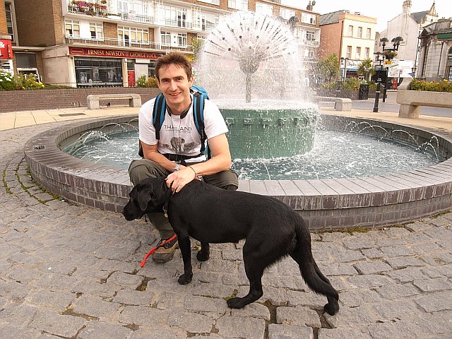
Simon & Zuka in Market Square - Dover

After walking north through suburban streets for approximately a mile we finally, and thankfully, left Dover behind, passing through a cemetery, and continued on a path under some curiously low bridges. We passed a large group of French hikers walking towards the town. I think one of them asked if they were going the right way for the boat. After crossing a railway line the metalled path eventually became a pleasant tree tunnel.


Leaving Dover, Dave had confidently predicted that the rest of the route that day should be fairly flat. Well, I have to say that after that statement was uttered we climbed fairly consistently (and steeply enough to really feel it) for well over a mile! Thanks Dave! Poor Sally got a bit left behind as we trudged up the hill - she must curse those of us with longer legs at times.
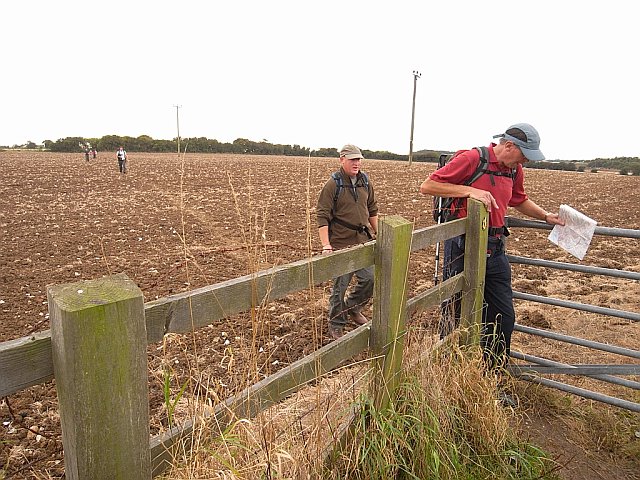

Once the ascent began to level off, the tree lined path (which was rather wet in places) ran between ploughed arable fields. As we approached the busy A2 traffic noise became more evident. The route was diverted east here to take us to a safer crossing point over a road bridge, and then returned west on the far side. Turning north again the path was again contained in a hawthorn tunnel, and on one short section there was rather a lot of litter.


Passing a field of horses, we just had to stop and make some more equine friends. I even shared a joke with one! Before reaching the village of Pineham (which is little more than a hamlet of farms) we passed another stone way marker. This one was rather dirty and some previous walkers had attempted to clean it up a bit so you could read the engraving.


We were all getting weary now but were fortunately on the home straight. Walking on a brief section of ‘roman road’ we encountered an enormous farm vehicle which took up the whole lane and had to pull aside to let us pass. Our route took us through the pretty village of Ashley where we had to walk up the lane, and unfortunately managed to rouse some fierce dogs. Crossing fields again at Minacre Farm we made friends with our last horse of the day (a smart piebald cob pony), before finally crossing the road bridge over the A256 and turning right up the lane to reach the High & Dry pub.


It was now about 6.20pm and the light was definitely beginning to fail – the combination of a late start and too much dawdling (plus the not inconsequential 16¾ miles we had walked) having taken its toll. As a walk, the part before Dover was far more interesting than the latter stages, but there was nothing much to complain about really – we had just been spoiled by rather a lot of wonderful scenery for much of both this walk and NDW8.

After a welcome and much needed drink and packet (or two) of crisps at the pub, we returned to Folkestone to the other waiting cars. It was by now pitch black and obviously quite impossible to photograph the White Horse from Tesco or anywhere else. Finally leaving the lay-by to drive home, I was personally very glad that I would not be driving on those narrow lanes near Pene again!


0 comments:
Post a Comment